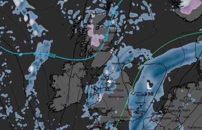
Snow looks set to fall over parts of the UK within hours as a wintry chill grips the country, the latest weather maps show. In Scotland, snow could linger on higher ground in Invernessshire, Ross & Cromarty, Perthshire and Argyll overnight tonight into Saturday, according to maps generated by WX Charts. In England, snow looks set to fall over parts of Cumbria, Lancashire, Northumberland, Durham and North Yorkshire later in the early evening on Saturday.
Some counties in South Wales might also see snow, with WX Charts' maps showing flakes falling in parts of Monmouthshire, Caerphilly and Torfaen at 6pm on Saturday. The Met Office's weekend weather forecast warns of unsettled conditions in the coming days, with the potential for snow, heavy rain and strong winds in various parts of the UK.
The forecaster says an area of low pressure moving from South Wales and South-west England towards Lincolnshire will bring a spell of heavy rain and strong, gusty winds.
Cold Arctic air will mean Saturday starts with "showery bursts" across Scotland, but parts of England and Wales will see heavy rain and strong winds.
Coasts along eastern England may see winds reaching 60mph or higher in exposed places, according to the Met Office.
Some spots could see 30-50mm of rainfall on Saturday. Where there's cold air, there is also the possibility of sleet and snow over higher ground.
The Met Office says: "The exact extent of wintry weather will depend on the track and intensity of the low."
It explained that a more southerly route would keep the wintry risk confined to the north while a more northerly path could bring sleet or snow to "modest elevations" in northern England and southern Scotland.

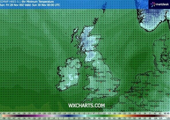
Temperatures on Saturday look set to fall below average for the time of year. Another map generated by WX Charts shows the mercury plunging as low as -4C in western Scotland at midnight on Sunday.
The Met Office says daytime highs will be in the mid-single figures Celsius for much of the north.
It expects slightly milder conditions further south, closer to the seasonal norm, though under the cloud, wind and rain it might not feel that way.
The most disruptive weather of this weekend may be seen down the eastern side of England where wet and windy conditions could persist.
High pressure following behind the low is expected to bring a brief spell of calm overnight into Sunday, with clearer skies raising the risk of fog.
Wet and windy weather is due to clear on Sunday, with dry, bright conditions in the Met Office's forecast. But another weather system looks set to bring cloud, wind and rain to parts of Northern Ireland.
Most can expect a drier, sunnier day, but it will still be colder than Saturday, according to the Met Office.
Counties where WX Charts shows snow:Invernessshire
Ross & Cromarty
Perthshire
Cumbria
Lancashire
Northumberland
Durham
North Yorkshire
Monmouthshire
Caerphilly
Torfaen