The India Meteorological Department (IMD) in its All India Weather Summary and Forecast bulletin has warned that the country is set to witness a dynamic and eventful weather pattern from January 19 to 24, 2026. Large parts of north and northwest India are likely to experience a spell of active and changeable weather as fresh western disturbances will move across the northern parts of the country in quick succession. The IMD warned that under the influence of three Western Disturbances in quick succession, wet spell is likely over Western Himalayan region during the next 7 days with possibility of isolated heavy rainfall/snowfall over Kashmir valley on 22nd & 23rd and Himachal Pradesh on 23rd January.
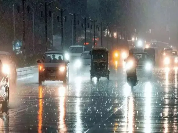
While the hills might experience a mix of rainfall, snowfall, dense fog, cold wave conditions, thunderstorms accompanied by gusty winds might be seen in the plains. Meteorologists have attributed the upcoming weather activity to a succession of western disturbances that will first affect the western Himalayan region before extending into the adjoining plains. These systems are likely to enhance precipitation across Jammu and Kashmir, Ladakh, Himachal Pradesh, and Uttarakhand, and later bring rainfall to parts of Punjab, Haryana, Uttar Pradesh, Rajasthan, and Delhi.
Isolated to scattered rainfall is likely over adjoining plains of northwest India during January 22 to 25th, the weather bulletin said. The IMD has forecast dense to very dense fog conditions are very likely to continue over Punjab, Haryana, Chandigarh, Uttar Pradesh and Bihar during the next two to three days.
During this period, Himachal Pradesh is expected to remain one of the most affected states as the state is likely to see heavy snowfall in the higher altitudes along with isolated rainfall on January 23. In Uttarakhand, thunderstorm activity accompanied by lightning is forecast on January 23, adding to concerns about travel disruptions in the hill districts. Scattered to fairly widespread rainfall and snowfall expected across the Western Himalayan Region, as well as parts of Punjab, Haryana, and Delhi.
ALSO READ: Who is DGP K Ramachandra Rao, father of Ranya Rao who is accused in gold smuggling case, under spotlight again after alleged viral 'obscene' videos?
-Isolated to scattered rainfall from January 22–25 is likely in northern states such as Haryana, Chandigarh, west Uttar Pradesh. The eastern part of Uttar Pradesh may see rainfall on January 23 and 24.
-Rajasthan: Light to moderate rainfall on January 22 and 23.
-As far as Delhi and adjoining Haryana–Chandigarh regions are concerned, there is going to be dry weather on January 20 and 21. However, scattered rainfall is likely on January 22 and 24 and fairly widespread rainfall is likely on January 23. Intermittent rainfall may ease dry conditions but could disrupt road and rail traffic during peak hours.
-Thunderstorms with lightning likely in Uttarakhand from January 23 and from January 24, isolated thunderstorms over Haryana, Chandigarh and Delhi, Punjab, and Uttarakhand, the IMD says.
-Thunderstorms with lightning mainly over Uttarakhand from January 25.
-In Southwest Bay of Bengal, you can expect squally weather on January 23 with winds of 35–45 kmph, gusting up to 55 kmph, likely to affect marine operations.
ALSO READ: Quote of the Day by ex Wipro CEO Azim Premji: 'If people are not laughing at your goals, your goals are too small'
Haryana, Chandigarh and Delhi: Dense fog likely till January 21.
Uttar Pradesh: Dense fog in isolated pockets till January 20.
Bihar: Dense fog expected in isolated areas till January 21.
Delhi: Dense fog at isolated places on January 20 and 21, possibly impacting road, rail and air traffic, including operations at IGI Airport.
Himachal Pradesh: Cold wave conditions very likely at isolated places on January 20 and 21.
Delhi: No cold wave forecast, but fog and rainfall may increase the chill factor, especially during mornings and evenings.
While the hills might experience a mix of rainfall, snowfall, dense fog, cold wave conditions, thunderstorms accompanied by gusty winds might be seen in the plains. Meteorologists have attributed the upcoming weather activity to a succession of western disturbances that will first affect the western Himalayan region before extending into the adjoining plains. These systems are likely to enhance precipitation across Jammu and Kashmir, Ladakh, Himachal Pradesh, and Uttarakhand, and later bring rainfall to parts of Punjab, Haryana, Uttar Pradesh, Rajasthan, and Delhi.
Isolated to scattered rainfall is likely over adjoining plains of northwest India during January 22 to 25th, the weather bulletin said. The IMD has forecast dense to very dense fog conditions are very likely to continue over Punjab, Haryana, Chandigarh, Uttar Pradesh and Bihar during the next two to three days.
Rain, snow activity to increase after January 22
According to the IMD bulletin, isolated to scattered rainfall to moderate rainfall and snowfall will continue over Jammu and Kashmir, and Ladakh region during January 20 and 21. Precipitation is forecast to become fairly widespread to widespread across the western Himalayan region from January 22 onwards, with activity peaking between January 22 and 24. Isolated heavy rainfall and snowfall are likely over the Kashmir Valley on January 22 and 23, while the higher reaches of Himachal Pradesh may witness isolated heavy snowfall on January 23.During this period, Himachal Pradesh is expected to remain one of the most affected states as the state is likely to see heavy snowfall in the higher altitudes along with isolated rainfall on January 23. In Uttarakhand, thunderstorm activity accompanied by lightning is forecast on January 23, adding to concerns about travel disruptions in the hill districts. Scattered to fairly widespread rainfall and snowfall expected across the Western Himalayan Region, as well as parts of Punjab, Haryana, and Delhi.
ALSO READ: Who is DGP K Ramachandra Rao, father of Ranya Rao who is accused in gold smuggling case, under spotlight again after alleged viral 'obscene' videos?
Rain to spread into the plains
Western disturbances moving eastward will bring rainfall to northwestern and northern plains and Punjab is likely to see scattered to fairly widespread light to moderate rain from January 22–25.-Isolated to scattered rainfall from January 22–25 is likely in northern states such as Haryana, Chandigarh, west Uttar Pradesh. The eastern part of Uttar Pradesh may see rainfall on January 23 and 24.
-Rajasthan: Light to moderate rainfall on January 22 and 23.
-As far as Delhi and adjoining Haryana–Chandigarh regions are concerned, there is going to be dry weather on January 20 and 21. However, scattered rainfall is likely on January 22 and 24 and fairly widespread rainfall is likely on January 23. Intermittent rainfall may ease dry conditions but could disrupt road and rail traffic during peak hours.
Thunderstorms, lightning and gusty winds
-From January 22 to 23, thunderstorms with lightning and gusty winds (30–40 kmph) at isolated places over Punjab, Haryana, Chandigarh, Uttar Pradesh and Rajasthan. Himachal Pradesh is likely to see thunderstorms with lightning on January 22 and 23.-Thunderstorms with lightning likely in Uttarakhand from January 23 and from January 24, isolated thunderstorms over Haryana, Chandigarh and Delhi, Punjab, and Uttarakhand, the IMD says.
-Thunderstorms with lightning mainly over Uttarakhand from January 25.
-In Southwest Bay of Bengal, you can expect squally weather on January 23 with winds of 35–45 kmph, gusting up to 55 kmph, likely to affect marine operations.
ALSO READ: Quote of the Day by ex Wipro CEO Azim Premji: 'If people are not laughing at your goals, your goals are too small'
Dense fog and cold conditions
Punjab: Dense to very dense fog in isolated pockets till January 20; dense fog on January 21.Haryana, Chandigarh and Delhi: Dense fog likely till January 21.
Uttar Pradesh: Dense fog in isolated pockets till January 20.
Bihar: Dense fog expected in isolated areas till January 21.
Delhi: Dense fog at isolated places on January 20 and 21, possibly impacting road, rail and air traffic, including operations at IGI Airport.
Himachal Pradesh: Cold wave conditions very likely at isolated places on January 20 and 21.
Delhi: No cold wave forecast, but fog and rainfall may increase the chill factor, especially during mornings and evenings.