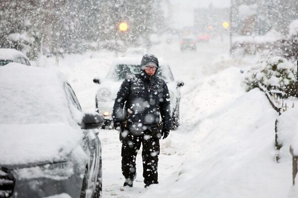
Brutal blizzards are on their way to bury 22 cities across the UK, with some areas to see snow depths reach an eye-watering 2ft as winter seemingly makes a U-turn to Arctic conditions. As we head into February, millions of Britons will be hoping that the bone-chilling weather is behind us. However, it looks like it will soon make a sharp return.
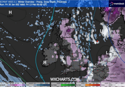
Despite it being relatively mild in recent weeks, WXCHARTS weather maps indicate that in exactly two weeks' time, vast swathes of the country will once again be covered by blizzards. The maps have turned purple, white, blue, and even yellow, indicating that heavy snow will fall. The worst hit areas will be buried under snow depths of 62cm (2ft).
At 6am on February 13, millions of people will draw back the curtains and uncover snow. Those in Perth and Kinross are set to be the hardest hit, with the area forecast to see snow depths hit 30cm.
Almost the entirety of Scotland will be covered in snow depths of at least 5cm. As we go down the country, the northeast and Yorkshire and the Humber could see snow depths reach 10cm.
Leicestershire, Worcestershire, and Northamptonshire are on track to see 5cm of snow. Central and mid Wales will see snow depths reach around the same amount.
The snow will skip London, Surrey, and the southwest, but East Sussex will see heavy snowfall.
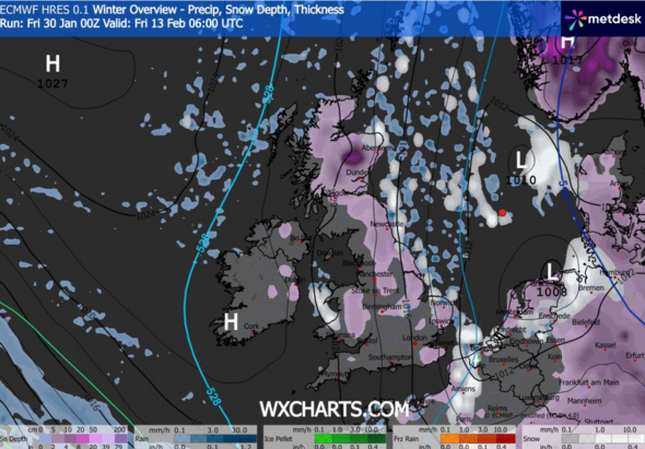
Fast forward to midday, and the snow will have increased massively. Weather maps indicate that Perth and Kinross will be blanketed in extreme snow depths of more than 60cm.
Aberdeen will be buried under 24cm of snow, whilst the Scottish Highlands will see a maximum of 9cm.
The snow will still be extremely heavy in England. The heaviest snow in the country will be Durham who will see 9cm of snow fall whilst North Yorkshire are forecast 2cm less.
Large parts of Yorkshire and the Humber are on track to see 5cm. Lincolnshire is forecast to see 4cm.
Similar snow depths are likely to be recorded in Wales with snow depths forecast to hover between 2cm-4cm. Londonderry in Northern Ireland and Ipswich will both record snow depths of 3cm.
The Met Office long-range forecast for February 4-13 says frontal systems over the North Atlantic, steered by a south-shifted jet stream, will likely approach the UK at times, but could stall as they hit a blocking area of high pressure to the north and northeast.
As the bands of heavy rain move southwards, "some snow will be possible on high ground in northern England and Scotland as they encounter colder air.
During the second week of February, a subtle shift southwards of these areas of low pressure is likelt to allow a greater chance of colder air to spread across northern UK at least, bringing an increased risk of wintry hazards for a time.
Scotland