The Danube River: Europe’s Continental Connector
Origins and Course
- Begins quietly in Germany’s Black Forest at Donaueschingen, where the Breg and Brigach streams meet.
- Flows eastward for about 2,860 km, finally spreading into the Black Sea.
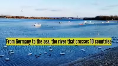
- Passes through 10 countries: Germany, Austria, Slovakia, Hungary, Croatia, Serbia, Bulgaria, Romania, Moldova, and Ukraine.
- Unique as the only major river in the world to cross four national capitals: Vienna, Bratislava, Budapest, and Belgrade.
Historical Significance
- Served as the northern boundary of the Roman Empire, acting as a defense line and transport route.
- Later became a dividing yet connecting line between the Habsburg and Ottoman empires, with castles and citadels built along its banks.
- By the early modern period, agreements regulated navigation and trade, turning the Danube into a shared economic route.
- After World War II, cooperation was formalized through the Danube Commission.
Geography and Ecology
- Danube Basin area: ~817,000 sq km.
- Fed by the Alps, Carpathian Mountains, and lowlands.
- Has over 300 tributaries, including the Drava, Sava, and Tisza.
- Landscapes include gorges, agricultural plains, and wetlands.
- Ends in the Danube Delta (Romania & Ukraine), one of Europe’s richest ecological zones, home to hundreds of bird and fish species.
Modern Role
- The Main–Danube Canal links it to the Rhine, creating a waterway from the North Sea to the Black Sea.
- Hydroelectric projects like the Iron Gate dams harness its energy.
- Environmental programmes aim to balance economic use with conservation amid pollution and climate pressures.
Symbolic Importance
The Danube flows across more borders than any other river, making it not just a waterway but a symbol of unity across Europe. Long before modern nations existed, the Danube was already connecting them—geographically, economically, and culturally.