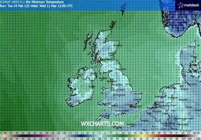

Snow is predicted to hit many parts of the UK, including several counties in England, in March. Although we are approaching spring, it looks like wintry conditions will make many more appearances over the next few weeks. According to the latest weather maps from WXCharts, there will be widespread snowfall on Wednesday, March 11. Weather maps predict freezing temperatures and snowfall as far south as London and Cornwall.
Snow is predicted to arrive at midnight and spread by 6am, becoming far more widespread by 12pm. February has been a rough month weather-wise in many parts of the UK. Some regions experienced flooding, while others saw snowfall on several days of the month. Although snowfall is hard to predict because of slight temperature changes and varying air moisture levels, current maps show snow in the middle of March, when some might expect conditions to become more spring-like.
According to the latest maps available from WXCharts, the counties that will be hit with snow on Wednesday, March 11 are:
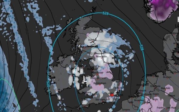
EnglandMeanwhile, the Met Office is expecting changeable conditions in and around this time, with Atlantic frontal systems expected to spread across the UK.
"These will bring spells of rain and perhaps strong winds, with the wettest conditions in the northwest, whilst the southeast will likely be driest," the forecast reads. "Temperatures are likely to be near to or slightly above normal overall. It is possible that longer spells of dry weather occur later in the month as more blocked pattern could develop, which could lead to some colder conditions too."
The Met Office also says that snow is possible in areas of high ground towards the end of February and beginning of March. For the start of next month, it says: "Winds will probably be strong at times, with a risk of gales. Temperatures are likely to be near to or slightly above average."