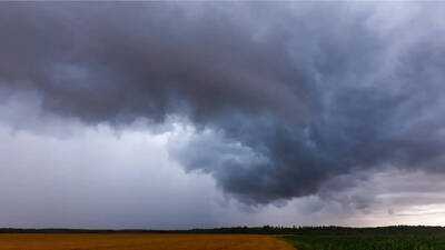
On April 14, tornado sirens were activated in Madison as a severe thunderstorm capable of spawning tornadoes swept through the northeastern sections of the city. The National Weather Service reported that radar indicated storm rotation, with the system moving eastward at approximately 20 mph, raising concerns about potential tornadoes and hail reaching sizes of up to three inches. Areas such as eastern Madison, Sun Prairie, Windsor, and Cottage Grove were highlighted as being in the storm's trajectory.
Simultaneously, a confirmed tornado was observed near Manchester in Delaware County, Iowa. Local authorities verified the tornado's presence, which was situated near Masonville and advancing east at 30 mph. This storm posed threats including a damaging tornado and hail comparable to tennis balls. Residents in Manchester, Delhi, Earlville, and nearby communities were alerted to possible dangers such as structural damage, flying debris, and the destruction of mobile homes.
In Grant County, Wisconsin, another confirmed tornado was reported in Fennimore. This tornado, also validated by law enforcement, was moving east at 25 mph and posed risks of damaging winds and hail. Areas including Montfort, Preston, and Centerville were noted as being in its path.
Officials urged residents in all impacted regions to seek immediate shelter, emphasizing that flying debris could be life-threatening and that significant damage to structures, vehicles, and trees was anticipated as the storms progressed through the area.