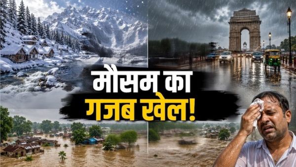
India is given the status of a 'subcontinent' across the world not only for its cultural or linguistic diversity, but also because its geography is not like that of any one country, but like that of an entire continent. It is often seen that when the mercury reaches near zero due to fresh snowfall on the high peaks of Gulmarg, Sonamarg or Pahalgam in Kashmir, at the same time the country's capital Delhi and NCR areas are getting drenched with thunder and torrential rains. If we move a few hundred kilometers east, the plains of Bihar and eastern Uttar Pradesh are battling floods of swollen rivers, stinging heat of 40 degrees and suffocating humidity of 85 to 90 percent. At first sight this paradox seems like a natural miracle, but if seen from the perspective of meteorology and physical geography, it is a completely planned scientific balance of India's specific landform, atmospheric pressure and monsoon wind system. Latitudinal Extent and Distance from the Sea: The Journey from the Tropics to the Temperate Zone The first basic reason for this huge difference in the weather of India is its huge latitudinal extent. India extends over an area of approximately 3,214 kilometers starting from 8°4' north latitude (Kanyakumari) in the south to 37°6' north latitude (Kashmir and Ladakh) in the north. The Tropic of Cancer passes right through the middle of the country, which divides India into two different climatic zones. The southern and central part of the country is tropical zone, where there is strong solar energy and high temperatures throughout the year, while the northern part falls in the sub-tropical and temperate zone. Apart from this, the effect of distance from the sea (continentality) also changes the weather. In the coastal areas located close to the sea, temperature fluctuations remain balanced due to sea winds, while the interior plains and mountainous parts of the country, being thousands of kilometers away from the sea, face continental climate, where extreme weather events are seen. Law of Altitude (Lapse Rate): Why does snow accumulate in the valleys of Kashmir? The biggest reason for premature snowfall or severe cold in Kashmir and Ladakh is the 'Normal Lapse Rate' of geophysics. This simple law of science states that as altitude increases above sea level, atmospheric pressure decreases and the temperature drops by an average of 6.5 degrees Celsius for every 1,000 meters (1 kilometer) of ascent. While Delhi and Patna lie in the plain basin at an altitude of only 150 to 210 meters above sea level, the average altitude of the Kashmir Valley is 1,600 to 2,200 meters, while the surrounding Pir Panjal and Zanskar mountain ranges are more than 3,500 to 5,000 meters high. When a Western Disturbance or cold streams of monsoon moisture originating from the Mediterranean Sea hits these high hills and rises up, due to the extremely low temperatures present there, the water vapor condenses directly into snow crystals instead of water droplets, which is called mountain rain or snowfall. Axis of Monsoon Trough: How do torrential rains occur in Delhi-NCR? Monsoon Trough is directly responsible for the heavy rains in the national capital Delhi and North-West India. The monsoon trough is actually a long invisible band of low air pressure, which extends from the Thar Desert of Pakistan to the Bay of Bengal. This trough does not always remain stable, but keeps oscillating towards north and south. Whenever a depression (low pressure cyclone) from the Bay of Bengal or Central India moves towards North India, it pulls the monsoon trough and places it just above Delhi-Haryana. In this situation, the moist westerly winds coming from the Arabian Sea and the easterly easterly winds coming from the Bay of Bengal collide with each other in the sky of Delhi. Due to this powerful convergence of winds, dense cumulonimbus clouds are formed, which cause heavy rains that submerge the roads of Delhi-NCR within a few hours. Hills of Nepal and effect of Bay of Bengal: Double attack of flood and humidity in Bihar The situation of Bihar is completely different from other states of the country and is extremely sensitive geographically. Bihar is a bowl-shaped plain, to the north of which lies the vast Himalayan catchment area of Nepal. When the monsoon is active, the moist winds from the Bay of Bengal first pass through the Gangetic plains without any major interruption and hit the foothills (Terai) of Bihar and Nepal. When there is heavy rain in the hilly areas of Nepal, millions of cusecs of water flows at high speed from the slopes there and directly enters the plains of North Bihar through rivers like Kosi, Gandak, Bagmati, Kamla Balan and Budhi Gandak. Due to the slope of the plain being very low, this water is not able to move quickly and takes the form of huge floods. On the other hand, in Bihar, when the continuous moisture rising from flood waters and river basins comes in contact with 35 to 38 degree sunlight, the relative humidity in the air reaches beyond 85 to 95 percent. This is the reason that as soon as the wind stops flowing there, the sweat from the body stops drying and an unbearable, sticky humid environment is created. Grand Confrontation of Atmospheric Systems: India's Diversity Is Its Identity India's meteorology is a perfect example of how three different atmospheric systems can be active over the same landmass at the same time. In the north, the Himalayas stand like a huge natural wall, which prevents the plains of North India from freezing by blocking the icy winds coming from Siberia and at the same time prevents the monsoon clouds from going out of the country and forces abundant rainfall. At the same time, the double sea branches coming from the Arabian Sea and the Bay of Bengal provide moisture to the eastern and western ends of the country at different times. This complex geographical fabric decides that on the same day a citizen of India is taking the help of hot pheran and kangri in Kashmir, a traveler from Delhi is carrying an umbrella and raincoat, and a farmer from Bihar is sitting on his boat hoping for some respite from the sultry clouds. This diversity is not an anomaly of any weather, but a unique and balanced cycle drawn by nature on the map of India.