The Palisades Fire, a massive wildfire in California, has been wreaking havoc in the Pacific Palisades area of Los Angeles. As of January 8, 2025, the fire has burned over 5,000 acres. What began as a small spark in Pacific Palisades, covering just 300 acres, has now surged past 4,000 acres in just hours. This dramatic expansion has been fueled by powerful windstorms, with wind speeds reaching over 50 mph, making firefighting efforts more challenging.


The exact cause is still under investigation, but a fierce windstorm has significantly spread the Pacific Palisades fire, intensifying the LA wildfires.
How many acres have the Palisades and Eaton wildfires burned?
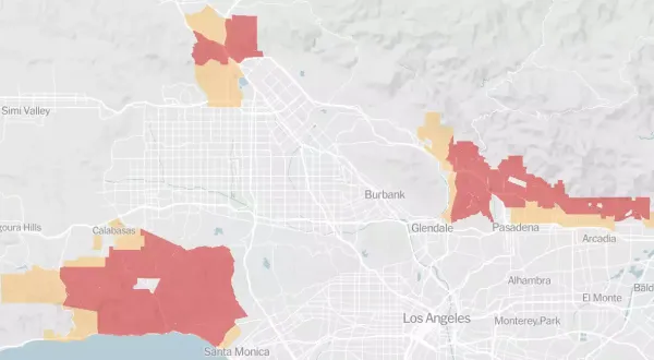
The Palisades and Eaton fires now cover more than 5,000 acres, with the Pacific Palisades fire alone expanding from 300 acres to over 4,000 in a few hours.
ET Year-end Special Reads
Buying a home in 2025? Here's how property market can shape up
18 top stock picks for 2025 from 6 leading brokers
Five big bangs that shook the corporate world in 2024

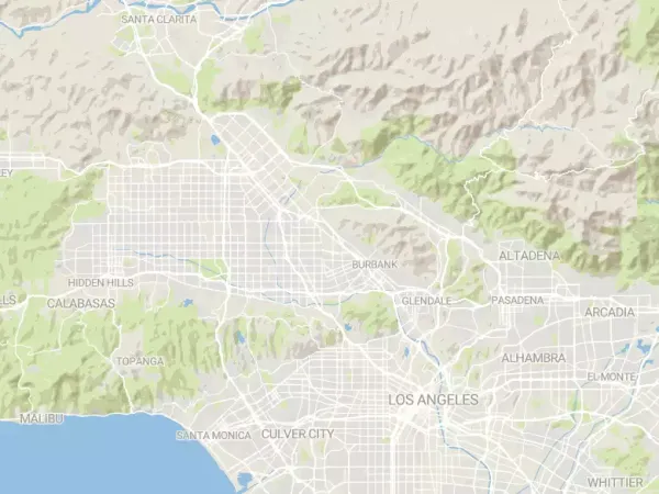
California wildfires map
Palisades Fire in California: State of Emergency Declared
Governor Gavin Newsom has declared a state of emergency in response to the fires, and President Biden has offered federal assistance.Palisades Fire in California: Evacuations and Impact
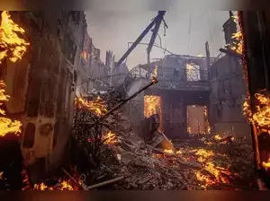
Approximately 30,000 residents have been evacuated from the Pacific Palisades area, including celebrities such as Spencer Pratt and Heidi Montag. The fire has destroyed homes and caused widespread power outages.
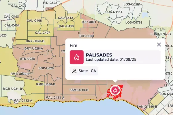
la evacuation zone map
Palisades Fire in California: Firefighting Efforts
Over 1,400 firefighting personnel are working to contain the fire, which remains at 0% containment. The National Weather Service forecasts continued strong winds, potentially exceeding 100 mph in some areas, exacerbating the already critical fire conditions.
la evacuation zone map
Palisades Fire in California: Travel and Safety Advisory
Travelers are advised to stay informed through local media and heed advice from authorities. Los Angeles International Airport is operational, but flights may experience turbulence. Travelers are advised to verify flight statuses and contact their airline or travel provider.FAQs:
What caused the LA wildfires in Palisades and Eaton?The exact cause is still under investigation, but a fierce windstorm has significantly spread the Pacific Palisades fire, intensifying the LA wildfires.
How many acres have the Palisades and Eaton wildfires burned?
The Palisades and Eaton fires now cover more than 5,000 acres, with the Pacific Palisades fire alone expanding from 300 acres to over 4,000 in a few hours.
Disclaimer Statement: This content is authored by a 3rd party. The views expressed here are that of the respective authors/ entities and do not represent the views of Economic Times (ET). ET does not guarantee, vouch for or endorse any of its contents nor is responsible for them in any manner whatsoever. Please take all steps necessary to ascertain that any information and content provided is correct, updated, and verified. ET hereby disclaims any and all warranties, express or implied, relating to the report and any content therein.


