New long-range predict around 10cm of could hit some regions of the country within the next fortnight. A cold blast, set to creep in for many from this weekend, is set to hang around - with some indications of snow over the next 10 to 14 days.
The says this is because easterly winds will become established across the UK thanks to high pressure. With it will come low temperatures and an . Met Office chief meteorologist, Paul Gundersen, said: “While some areas will see showers or some patchy rain on Friday (February 7) and through the weekend, there will be the potential for some sleet or snow as temperatures drop, mostly over higher ground in central and southern areas. The cold will be accentuated at times by brisk easterly winds.
“There will be variable, and at times large amounts of cloud over the coming days with the clearest and sunniest across the northwest of the UK. There will also be icy patches and overnight frost in places. For most, the weather is not expected to be disruptive."
READ MORE:
Looking ahead to next week and beyond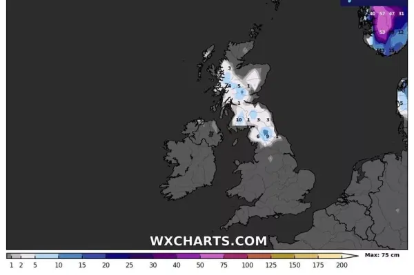
But looking further ahead into next week and the latter half of the month, the high pressure is expected to be centred over Scandinavia, the forecaster said. "This pattern leads to a cold, east or southeasterly air-flow across the UK. As mentioned, this will be accompanied by some light rain and hill snow early next week, mainly in the south of the UK, before drier conditions become established later in the week," it added.
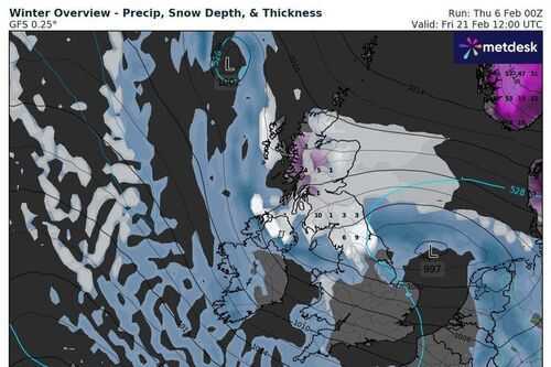
And it certainly does not rule out more snow up until February 21. In its long-range forecast up until then, it says there is a "continued risk of some wintry precipitation at times".
Current weather maps from WXCHARTS show a huge wall of snow smashing into Britain at around midday on February 21. Currently it depicts the northern end of the country, including the likes of Newcastle and to cop the brunt of it, with up to 10cm in rural locations. This, as it currently shows, seems to spread southerly by Saturday, February 22 - reaching parts of northern Wales.
February snow risks into March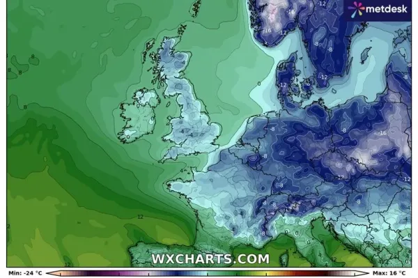
Focusing on the latter half of the month, up until March 6, the Met Office does not rule out yet more snow risks.
"Weather patterns in the UK are most likely to be slowly evolving. It is most likely that high pressure to the east or northeast of the UK will dominate at first in some form or another, but with time this may decline, allowing an erratic transition to rather more unsettled and possibly less cold conditions. During this transition there is the possibility of more prolonged rain or snow developing, at least for a time, but confidence in these details is currently very low," it says.