Indian States That Share a Border With Pakistan: The vicious Pahalgam terror incident in Kashmir on April 22, 2025, forced the India-Pakistan relationship back into the spotlight and strained ties with neighboring nations.

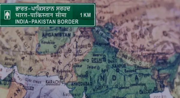
The International Border (IB), which runs 3,323 kilometers between India and Pakistan, is known as the shared border. It extends from the western state of Gujarat to the northernmost union territories. This border is highly guarded, geopolitically crucial, and among the most hazardous. In contested areas, the various portions of this boundary are sometimes known as the Line of Control (LOC).
The following is a list of Indian states and union territories that border Pakistan, based on data from the Ministry of Home Affairs:
| State/UT | Border Length (km) | Border Name/Section |
|---|---|---|
| Jammu & Kashmir | ~1,222 | Line of Control (LoC), IB |
| Ladakh | ~857 | AGPL, LoC |
| Punjab | 425 | International Border (IB) |
| Rajasthan | 1,048 | International Border (IB) |
| Gujarat | 512 | International Border (IB) |
Kashmir and Jammu
After Article 370 was repealed, Jammu & Kashmir, formerly a princely state, became a union territory. The state and Pakistan share the perilous Indian border, which is known as the Line of Control (LoC) for the most part. Due to continuous conflicts from the years of independence, the region is hilly, has a diverse population, and has a significant military presence. Due to frequent ceasefire breaches and security concerns, this boundary is particularly delicate.
Following the division of Jammu and Kashmir in 2019, Ladakh was created as India’s northernmost union region. In the Gilgit-Baltistan region, Pakistan borders it; in the Siachen region, this is known as the Actual Ground Position Line (AGPL). The border of Ladakh is inaccessible due to its high elevation and strategically important locations. The boundary also extends to Afghanistan and China.
The Punjab
Punjab is located in northwest India and borders Pakistan’s Punjab province by 425 kilometers. The Wagah-Attari crossing, where the Beating Retreat ritual is held every day, is the border’s most well-known feature. Fertile and historically significant, the region was divided at the 1947 Independence.
The state of Rajasthan
Rajasthan, the biggest state in India in terms of area, has a 1,048-kilometer border with the provinces of Sindh and Punjab in Pakistan. The Thar Desert, which the border touches, is a very arid region with challenging security logistics. Munabao is a significant border location with a significant integrated commerce checkpoint.
Gujarat
Gujarat is a state in western India that borders Pakistan by 512 kilometers. The Zero Point at the southwest end marks the boundary, which passes across the salt plains of the Rann of Kutch. Conflict has occurred here in the past, such as the Rann of Kutch incident in 1965.
What Is the Name of the India-Pakistan Border?
Border International (IB): India and Pakistan’s officially recognized border, which runs across Gujarat, Rajasthan, and Punjab. Another name for it is the Radcliffe Line.
The military boundary between Pakistani and Indian-controlled regions of Jammu & Kashmir is known as the Line of Control (LOC).
The line between Indian and Pakistani positions in the Siachen Glacier region, which is mostly in Ladakh, is known as the Actual Ground Position Line (AGPL).
Three Indian states—Punjab, Rajasthan, and Gujarat—as well as two union territories—Jammu and Kashmir and Ladakh—form the boundary between India and Pakistan. The border designations are distinguished as the International Border, Line of Control, and Actual Ground Position Line based on the region and context. The Indo-Pak border is one of the most delicate and complex in the world since each border has unique physical, historical, and geopolitical significance.


