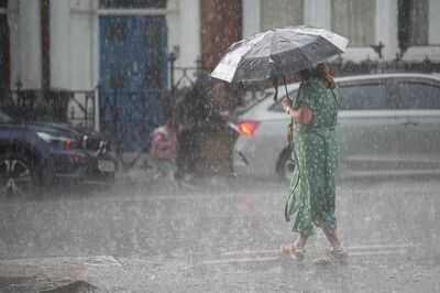
Britain's heatwave is set to come crashing to an end in just a few hours' time as temperatures take a sudden drop - while more rain is expected across the country.
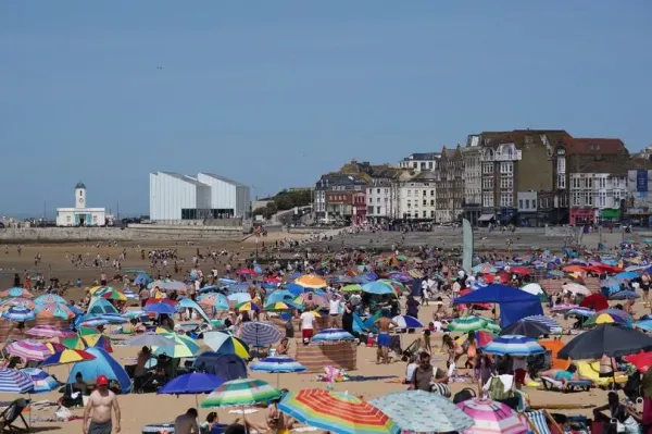
The UK recorded its warmest day of the year so far on Saturday as the mercury topped 33C in Surrey - but weather conditions are now set to take a marked turn, becoming cooler from today onwards as a more unsettled pattern develops into next week. Outside of the southeast, temperatures could struggle to get above 20C today - and plenty of rain is also expected in the coming days.
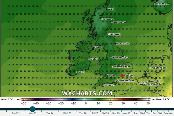
Weather maps from WXcharts show daytime minimum temperatures even dropping into the single figures in Cumbria and central Scotland, signalling an end to the current spell of warm weather.
READ MORE: Home Bargains shoppers 'running' to stores for 'gorgeous' £2 item
READ MORE: Dave Myers’ widow shares his struggles with illness and heartache before sad death
Forecasters say a dip in the jet stream is set to move an area of low pressure toward towards the UK from Monday onwards, meaning cooler air will be blowing in from the Atlantic.
Explaining the change in the weather for next week, the Met Office's Alex Deakin said in a forecast last night: "We are going to see some pretty signifcant changes. Really, we need to be looking at not just at what the jet stream's doing above our heads but out in the Atlantic.
"We have a dip, a trough in the jet stream, and that is disrupting over the next couple of days - it kind of breaks away into its own little circulation, and pushes an area of low pressure up to the west of the UK, before it all merges back together to form that pattern that we see initially.
"What those changes mean is that we are going to see some hot conditions past the next few days, but by the time we get to Monday... the winds will be coming in from the west, and trying to bring in cooler air from the Atlantic."
He added that over the course of the next week, "generally the further south and east you are the drier it will be, and the further north and west you are - the closer you are to those low pressure systems - the greater the chance of seeing outbreaks of rain.
The UK Health Agency's heat health alert for all of England is meanwhile set to expire on Monday.
The warning had been issued to the NHS and healthcare sector over fears of increased strain on vital services due to the heatwave.
Today, another warm day is forecast for much of the UK, though some showers are possible in the north.
Maximum temperatures of 27C are expected in London, 21C in Manchester, 20C in Cardiff and 19C in Edinburgh and Belfast.
UK weather forecast Sunday:Fresher for most with breezy westerly winds bringing sunshine and scattered showers, a few thunderstorms in the northwest. Drier and brighter in the southeast but staying warm and humid here.
Outlook for Monday to Wednesday:Breezy westerly winds continue to bring a mixture of sunshine and showers, these heaviest in the north and west. Near average temperatures, though feeling warm in the sunshine. Fresher nights.