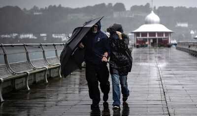
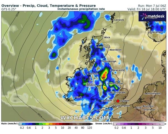
A huge rain bomb is set to hit nearly all of the UK later this month, bringing lower temperatures folllowing an intense heatwave. WXCharts weather maps forecast 650 miles of rain to sweep across the country at 6pm on Friday, July 18, after several days of scorching heatthat could see the mercury jump to as high as 32C in some areas.
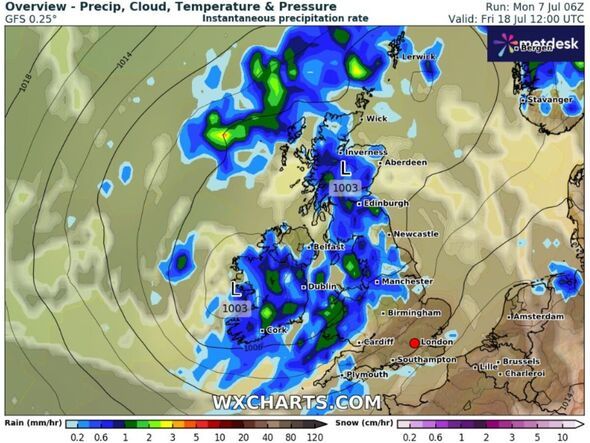
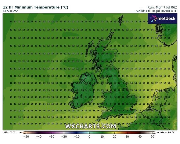
The rain will be heaviest over the northwest of the UK (Carlisle, Kendal, Lancaster), and parts of the Midlands (Chester, Nottingham, Peterborough). Rain will mainly hit across the west of the country, avoiding the south of England and the east coasts of England and Scotland. The latest weather maps from WXCharts also show the upcoming UK heatwave is set to come to an abrupt end, with lows of 8C in an area of Wales at 6am on July 18, and just 11C in London.
The Met Office long-range weather forecast for July 12-21 says: "Settled at first, with very warm or hot weather quite widely across the UK. There is a small chance of a few thunderstorms, but most areas will likely be dry.
"Early next week, a transition to less hot conditions is expected, but with uncertain timing. This could bring an increasing chance of some rain or showers, perhaps thundery, but there is scope for very warm or hot conditions to persist in more eastern and southern areas.
"Beyond midweek, a rather changeable pattern is anticipated with some rain or showers possible at times, which could be heavy and thundery, but interspersed with drier interludes.
"Whilst a downward trend in temperature is anticipated, it will still likely be warmer than average, especially in the south and east, where hot spells remain possible."
On Monday, the Met Office issued a new update on the upcoming UK heatwave to hit the country in a matter of days.
Deputy Chief Meteorologist Dan Holley said: "High pressure from the Atlantic will gradually exert its influence over the UK this week. We'll see temperatures build day-on-day, with the potential for hot conditions to become quite widespread by the end of the week and into the weekend.
"On Wednesday, temperatures could reach up to 28C in parts of England, climbing to 30C on Thursday and 32C by Friday.
"By this stage, heatwave criteria are likely to be met in parts of England and Wales, and in parts of Scotland over the weekend.
"High temperatures are likely to persist into the weekend, especially away from coasts with onshore winds, reaching the low 30s in portions of England and Wales, and accompanied by rising humidity and warmer nights.
"This heatwave is likely to last longer than previous ones so far this summer, and affect a wider area, with the focus for some of the highest temperatures displaced across more central and western areas at times. In addition, pollen and UV levels will also be very high in some areas."