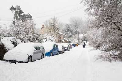
Britain is facing a prolonged blast of wintry weather as new snow maps reveal a double Arctic storm set to batter parts of the UK for multiple days, with bitter cold likely well into early January. Forecasts from WXCharts and Netweather TV from today show the first wave of snow arriving around New Year's Day. At around 3pm, snow risk rapidly increases across eastern England, Scotland and parts of the Midlands, with higher ground especially vulnerable to the white stuff.
However, this might only be the beginning. A second Arctic surge is shown developing early the following week, reinforcing the cold spell rather than allowing milder Atlantic air to break through. By Tuesday, January 6, snow risk will intensify again, with maps showing a corridor of snowfall stretching from Scotland down through northern England and into parts of the Midlands.
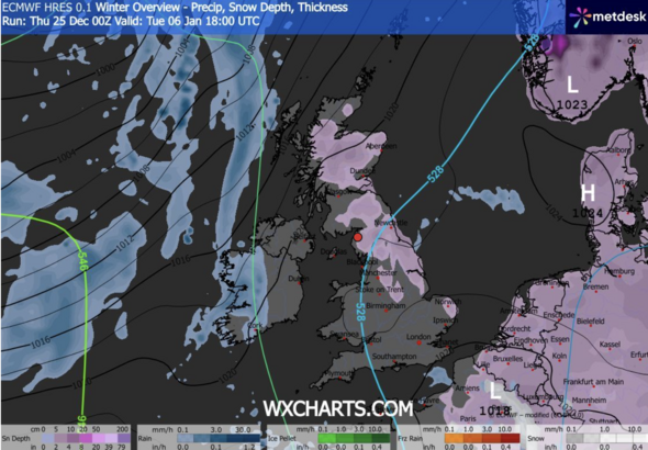
Weather models suggest this second system could be more disruptive, with deeper cold air in place and snowfall rates high enough to lead to rapid accumulations. Upland areas could see several centimetres of snow, while even lower elevations may experience temporary settling, especially during nighttime and early morning hours.
Motorists and travellers are advised to monitor forecast updates closely, because even minor weather shifts could rapidly change where the heaviest snowfall falls.
What the Met Office is forecastingThe Met Office acknowledges that predicting snow is difficult, and its forecast differs.
The weather agency's long-range forecast from December 30 to January 8 predicts: "High pressure is likely to dominate across the UK through to the end of the year, centred to the west or northwest over the North Atlantic. This will likely maintain relatively settled conditions at first, but with a little light rain or drizzle in places and a few showers possible along some coasts exposed to the northerly wind.
"Around the turn of the year, high pressure is likely to shift a little farther away from the UK, allowing a greater chance of more changeable conditions to develop. This will bring an increased risk of some rain or showers at times which, with cold air close to the UK, may bring some wintry hazards to some places. Temperatures will probably be near or slightly below average for this period overall."