A significant late-season winter storm is set to make travel in various parts of the United States "nearly impossible" this weekend, as it brings heavy snowfall, ice, and strong winds, according to meteorologists. The National Weather Service (NWS) has issued alerts for states including Minnesota, Michigan, Wisconsin, North Dakota, and South Dakota, warning residents of dangerous conditions that could lead to power outages and major travel disruptions.
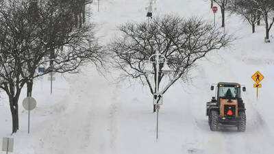
In Minnesota, the heaviest snowfall is anticipated, with several NWS offices predicting extended snow through Saturday night into early Sunday. Accumulations are expected to range from 7 to 12 inches in parts of the north-west and west-central regions, while a broader area of the state may see totals between 4 to 12 inches. Northern counties could receive 6 to 9 inches, and central areas might see 4 to 6 inches. Forecasters warn that conditions will deteriorate rapidly, with visibility potentially dropping below a quarter mile. Roads are likely to become snow-covered and treacherous, making travel "very difficult to impossible," especially during heavier snowfall periods.
To the east, ice storms are expected to create significant hazards in northern Michigan and northern Wisconsin. In Michigan’s Upper Peninsula, some areas may experience ice accumulations of up to four-tenths of an inch, with strong winds reaching 35 mph likely to worsen damage. The NWS has cautioned that "power outages and tree damage are likely," indicating that travel could become "nearly impossible." Similar conditions are anticipated in northern Wisconsin, where freezing rain and sleet could coat roads, trees, and power lines. Ice accumulations of up to three-tenths of an inch are forecast, with gusty winds heightening the risk of disruptions. Eastern Minnesota and northern Wisconsin may also see a mix of snow, sleet, and freezing rain, with ice accumulations of up to a quarter inch alongside several inches of snow. Conditions are expected to improve in some areas later on Saturday as warnings begin to lift.
In North Dakota, while snow totals are predicted to be lower, they are still expected to cause disruptions. Forecasts indicate between 1 and 6 inches of snow, with winds up to 35 mph reducing visibility and making travel "very difficult." South Dakota is also under winter storm warnings, with snow accumulations ranging from 1 to 9 inches depending on the area. Blowing snow and reduced visibility are anticipated in certain regions. Officials are advising residents to postpone travel if possible and to prepare for potential power outages as the storm progresses.