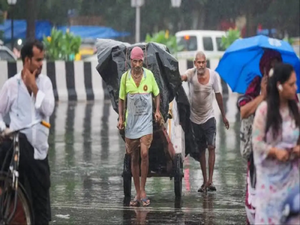
Weather conditions are expected to remain unsettled across large parts of India on September 2, with several regions likely to experience heavy rainfall, thunderstorms and strong winds. According to the weather forecast, as many as 23 states and Union Territories could see adverse conditions during the day, with wind speeds potentially reaching 70 to 75 kmph in some places.
The changing weather pattern may affect northern, central, eastern, western and southern parts of the country. Residents have been advised to remain cautious, particularly in areas vulnerable to waterlogging, falling trees, lightning and landslides.
The forecast indicates the possibility of heavy rain and thunderstorms across Uttar Pradesh, Bihar, Delhi, Haryana, Rajasthan, Himachal Pradesh, Uttarakhand, Punjab, Jammu and Kashmir, Ladakh, Madhya Pradesh, Chhattisgarh, Jharkhand, West Bengal, Odisha, Gujarat and Maharashtra.
Assam and Tripura in the Northeast may also witness unsettled conditions. In southern India, Kerala, Tamil Nadu, Karnataka and Telangana are among the states where rainfall activity is expected.
Strong winds accompanying thunderstorms could reach speeds of around 70 to 75 kmph at isolated locations. Such conditions may result in fallen tree branches and could also affect standing crops and outdoor infrastructure.
Delhi is expected to experience cloudy and rainy conditions along with the possibility of thunderstorms. Winds could reach around 40 to 50 kmph during periods of intense weather activity.
The national capital's maximum temperature is expected to remain close to 31 degrees Celsius, while the minimum could hover around 26 degrees Celsius.
People in Delhi-NCR should exercise caution while travelling during intense rainfall, especially in locations prone to waterlogging and traffic disruption.
Rainfall and thunderstorms are also expected across several parts of Uttar Pradesh. Districts that could experience adverse weather include Meerut, Ghaziabad, Gautam Buddha Nagar, Moradabad, Mathura, Agra, Sonbhadra, Kanpur, Mirzapur, Fatehpur, Banda, Pratapgarh, Chitrakoot and Kaushambi.
Kasganj, Hardoi, Mainpuri, Etawah, Shamli, Budaun, Gorakhpur, Prayagraj and Deoria may also see rainfall accompanied by thunder and gusty winds.
In Lucknow, the daytime temperature is expected to stay around 30 degrees Celsius, while the minimum temperature could be approximately 26 degrees Celsius.
Several districts of Rajasthan may also witness rain, thunderstorms and strong winds. Weather activity is expected in Tonk, Ajmer, Alwar, Jaisalmer, Jaipur, Barmer, Bharatpur, Kota, Dungarpur, Phalodi, Didwana, Jodhpur and Pali.
Wind speeds in some of these areas may reach 45 to 50 kmph during thunderstorms.
Jaipur is expected to record a maximum temperature of around 33 degrees Celsius and a minimum of approximately 26 degrees Celsius. Rain, thunder and gusty winds could affect the city and surrounding areas during the day.
Extra caution may be required in Himalayan and other mountainous areas. Himachal Pradesh, Uttarakhand, Jammu and Kashmir and Ladakh could receive rainfall that may increase the possibility of landslides, particularly in vulnerable locations.
Travellers heading towards hill destinations should keep track of the latest local weather and road advisories before beginning their journey. Heavy rainfall can make mountain roads slippery and may trigger temporary road closures or falling debris.
Thunderstorm activity could also bring lightning to parts of eastern India, while isolated locations may experience hail along with rain.
During thunderstorms, people should avoid staying in open fields or taking shelter underneath isolated trees, electricity poles and other tall structures. Outdoor travel should preferably be postponed during periods of intense lightning or strong winds.
Loose objects on balconies, rooftops and other exposed areas should also be secured if strong winds are expected.
Farmers may need to take precautionary measures to protect harvested produce, standing crops and agricultural equipment from heavy rain and strong winds.
People living in coastal regions should also closely follow official weather advisories. Fishermen should pay particular attention to warnings related to rough sea conditions and strong winds before venturing out.
Multiple atmospheric systems are believed to be contributing to the widespread rainfall and thunderstorm activity.
Strong moisture-laden winds from the northwestern Bay of Bengal could support increased rainfall over parts of the country. A cyclonic circulation at lower atmospheric levels over central Uttar Pradesh is also influencing weather conditions.
Another upper-air cyclonic circulation over northeastern Assam and adjoining areas may further support rainfall and thunderstorm development in eastern and northeastern India.
The combined influence of these systems could keep weather conditions unstable across several states, bringing spells of heavy rain, thunderstorms, lightning and gusty winds.
Residents in affected areas should continue checking official and local weather updates, particularly before travelling or undertaking outdoor activities, as conditions can change quickly during active monsoon weather.