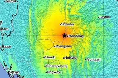
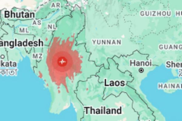
A terrifying map has revealed the impact of the Myanamar earthquake as thousands of people were evacuated with dozens of people feared dead.
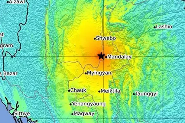
Data produced by the United States Geological Survey has revealed the devastating magnitude of the disaster. It comes after the earthquake struck central Mynamar on Friday, sparking chaos to erupt hundreds of miles away in .
Prime Minister Paetongtarn Shinawatra called an emergency meeting to examine the impact of the tragedy, with a magnitude listed at 7.7 by the USGS - although local seismologists claimed it reached 8.2 on the Richter scale. Two deaths have been confirmed at this time, although many more are expected. A second earthquake was recorded just 12 minutes later, with a slightly lower magnitude of 6.4.
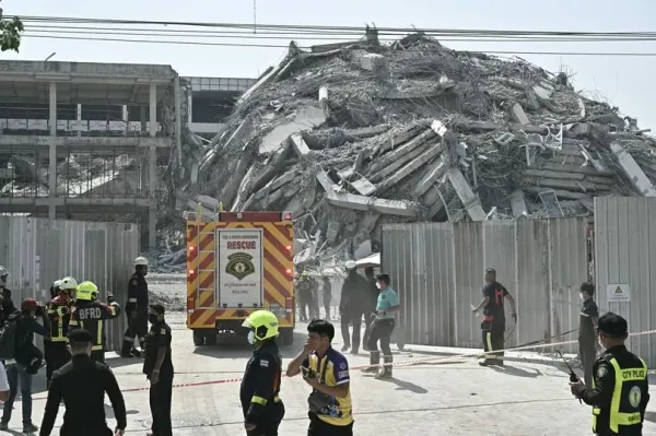
Shocking images showed the aftermath after a crane collapsed onto a multi-storey building in Bangkok. Fraser Morton, a tourist from , was in one of many centres shopping for camera equipment as horror unfolded around him.
READ MORE:
He said: "All of a sudden the whole building began to move, immediately there was screaming and a lot of panic. I just started walking calmly at first but then the building started really moving, yeah, a lot of screaming, a lot of panic, people running the wrong way down the escalators, lots of banging and crashing inside the mall.”
READ MORE:
Like thousands of others in downtown Bangkok, Fraser sought refuge in Benjasiri Park, away from the tall buildings. “I got outside and then looked up at the building and the whole building was moving, dust and debris, it was pretty intense,” he added. “Lots of chaos.”
The US Geological Survey and Germany’s GFZ centre for geosciences said the incident was at a shallow 6.2 miles, with an epicentre in neighbouring , according to preliminary reports. A state of emergency was declared in six regions and states in Myanmar.
State-run MRTV television said the military-run government’s proclamation includes the capital Naypyitaw and Mandalay. Alarms went off in buildings as the earthquake hit around 1.30pm local time, and startled residents were evacuated down staircases of high-rise buildings and hotels in densely populated central Bangkok.
They remained in the streets, seeking shade from the midday sun in the minutes after the quake. The quake was forceful enough to send water sloshing out of pools, some high up in high-rises, as the tremor shook.
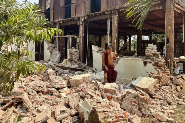
In the capital Naypyitaw, the earthquake damaged religious shrines, sending parts toppling to the ground, and some homes. In Mandalay, the country’s second-largest city and close to the epicentre, the earthquake damaged part of the former royal palace and buildings, according to videos and photos released on .
While the area is prone to earthquakes, it is generally sparsely populated, and most houses are low-rise structures.